Region
Southwest United States
A region where ancestral ceremonial landscapes, living Indigenous communities, desert scale, and modern spiritual travel all require careful framing.
Quick explainer
How to use this regional lens
This short explainer tells users what makes the region distinct, who it suits, and how to move through it.
Regional character
A sacred geography with its own travel rhythm
The Southwest is especially strong because it holds very different sacred registers together: Chaco Culture preserves an ancestral ceremonial landscape, Taos Pueblo remains a living Indigenous community, Mesa Verde protects a vast Ancestral Puebloan settlement landscape, and Sedona shows how modern spiritual travel can gather around landforms in the same broad region.
That gives the region a distinct tone: more emphasis on cultural framing, land care, and pacing, and less reliance on simple attraction copy or one-size-fits-all sacred language.
Featured places
Sacred places in Southwest United States

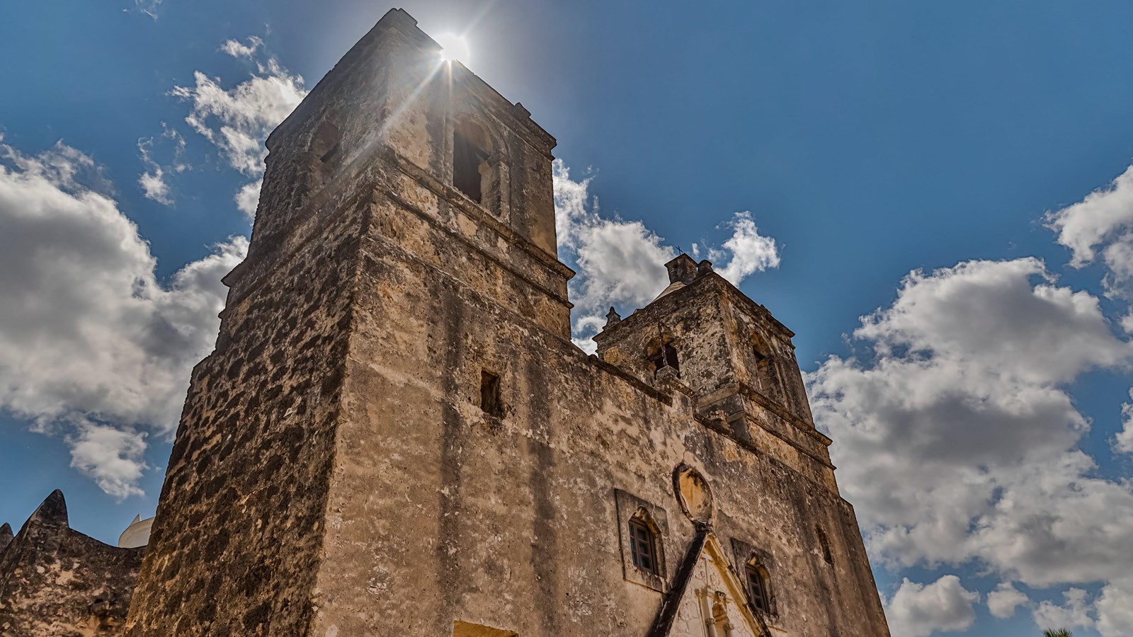
San Antonio Missions
A UNESCO-listed Texas mission chain of churches, compounds, irrigation canals, parish life, and river-corridor heritage.
Mission Concepcion
A San Antonio mission where an old church continues in worship, with grounds and river history keeping the larger mission setting visible.
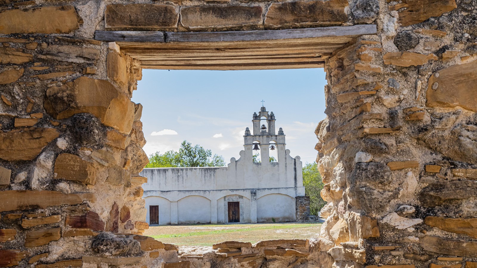
Mission San Francisco de la Espada
A quieter southern San Antonio mission where church life, irrigation traces, open grounds, and former fields remain part of one Catholic landscape.
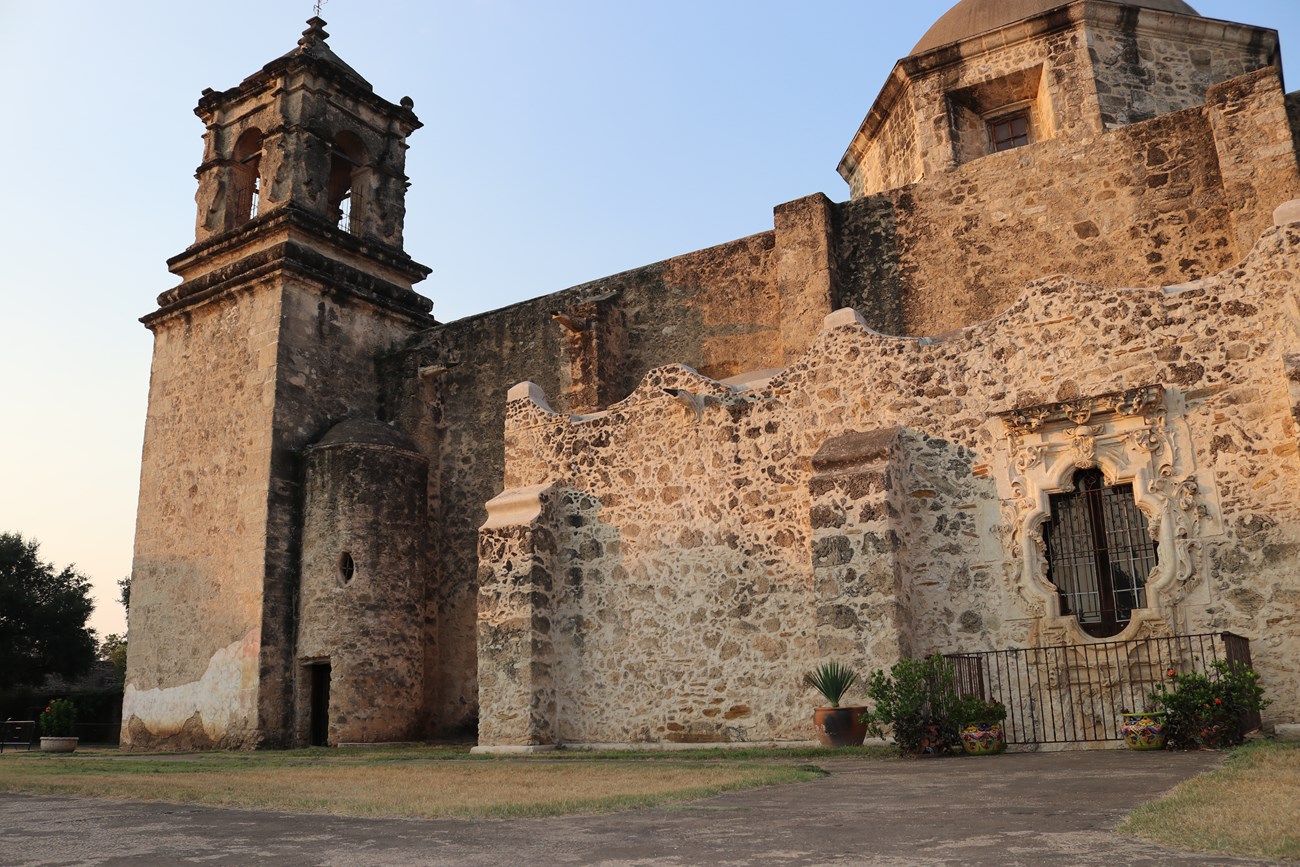
Mission San Jose y San Miguel de Aguayo
A substantial San Antonio mission enclosure where courtyards and walls still direct attention back to an active Catholic church.
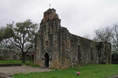
Mission San Juan Capistrano
On San Antonio’s southern mission route, San Juan offers a quieter parish church, broad grounds, and a landscape memory of fields and community life.

Chaco Culture
Remote canyon roads, monumental masonry, and kiva plazas make Chaco a slow landscape visit.
Lesser-known places
Keep the region broader than the headline anchors
These pages widen the regional field beyond the most obvious route stops.

Planning signals
Seasonality, access, and site-type patterns
These quick signals make the regional planning shape explicit without forcing a full itinerary yet.
Best by constraint
Use the region through practical constraints, not just one flat place list
These shortcuts are the first pass at long-tail planning questions like mythology, archaeology, season, car-light access, and first-time fit.
FAQ
Questions this regional hub should answer quickly
Keep exploring
Continue through the strongest relationships inside this region
Links
Reference links and sources
Direct reference links for this entry, with supporting source material below.
- UNESCO entryAuthority source for the ancestral Pueblo ceremonial landscape preserved in Chaco Culture.
- Wikipedia entryWikipedia article for Sedona.
- What Is A Vortex? | Visit SedonaLocal destination framing for Sedona’s vortex culture.
- Crescent Moon Ranch/Red Rock Crossing | Visit SedonaLocal guide to Red Rock Crossing and Crescent Moon Ranch.
- Cathedral Rock Trail No. 170 | Coconino National ForestOfficial trail and access information for the Sedona landscape.
- Sedona (Q80041)Entity anchor for Sedona.
- Cathedral Rock (Q5052274)Entity anchor for the iconic adjacent landform.
- Chaco Culture (Property 353)Authority source for the ancestral Pueblo ceremonial landscape preserved in Chaco Culture.
- Taos Pueblo (Property 492)Authority source for Taos Pueblo as a living Indigenous community and ceremonial settlement.
- Mesa Verde National Park (Property 27)Authority source for the ancestral Pueblo settlement landscape at Mesa Verde.
- SedonaWikipedia article for Sedona.